Heybrook Lookout Trail
Hike to Heybrook Lookout in Mount Baker Snoqualmie National Forest #Hiking #Mountain #Forest #Overlook
- Distance: 2.0 mi
- Elevation gain: 256 m
- Maximum elevation: 507 m
- Elevation loss: 256 m
- Minimum elevation: 251 m
- Moving time: 1 h 6 m
- Moving speed: 1.8 mph
- Maximum speed: 5.9 mph
- Total time: 2 h 2 m
- Global speed: 1.0 mph
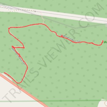
Interactive trail map
Trail profile
- Distance: 2.0 mi
- Elevation gain: 256 m
- Maximum elevation: 507 m
- Elevation loss: 256 m
- Minimum elevation: 251 m
- Moving time: 1 h 6 m
- Moving speed: 1.8 mph
- Maximum speed: 5.9 mph
- Total time: 2 h 2 m
- Global speed: 1.0 mph
About this trail
Name: Heybrook Lookout Trail trail, distance, elevation, map, profile, GPS track
Start: Heybrook Lookout Trail, Snohomish County, Washington, 98256, United States (47.80845 -121.53505)
End: Heybrook Lookout Trail, Snohomish County, Washington, 98256, United States (47.80847 -121.53508)
Coordinates: 47.80778 -121.53508 47.81170 -121.52531
Other hiking, mountain biking, running and outdoor activity trails
Click on a trail to view its statistics, map and profile.
Heybrook Lookout Trail in Mount Baker Snoqualmie National Forest
United States > Washington > Snohomish County
The Heybrook Lookout Trail in the Mount Baker-Snoqualmie National Forest offers a vibrant journey through moss-draped trees and fern-lined forest paths. As you ascend, glimpses of the surrounding Cascade peaks become more frequent, with Mount Persis and Mount Index commanding attention above the treeline. The…
Distance: 2.0 mi • Elevation gain: 264 m • Maximum elevation: 509 m
Northern part of the Pacific Crest Trail (PCT)
United States > Oregon > Klamath County
Hike on the Pacific Crest National Scenic Trail from Crater Lake to Canada Border through Oregon and Washington along the Sierra Nevada and Cascade mountain ranges. #Hiking #Mountain #SierraNevada #Cascade #Nature #Forest #Park #PCT
Distance: 744.6 mi • Elevation gain: 44,308 m • Maximum elevation: 2,307 m