Door Trail in Badlands National Park
The Door Trail is a short but exciting adventure that immerses you into the park’s rugged, lunar-like terrain. After the easy walk on a boardwalk, the trail becomes more uneven, winding through eroded gullies and fascinating rock formations, rewarding you with stunning panoramic views of the Badlands' otherworldly landscape. It’s well worth going beyond the boardwalk to fully appreciate the raw beauty of the park. #Hiking #Rock #Nature
- Distance: 0.8 mi
- Elevation gain: 16 m
- Maximum elevation: 803 m
- Elevation loss: 16 m
- Minimum elevation: 786 m
- Moving time: 22 m
- Moving speed: 2.3 mph
- Maximum speed: 3.8 mph
- Total time: 23 m 23 s
- Global speed: 2.2 mph
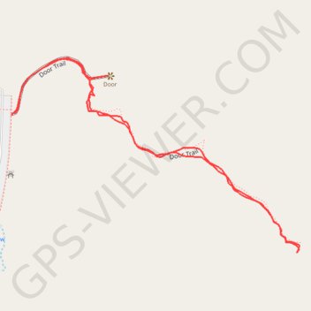
Interactive trail map
Trail profile
- Distance: 0.8 mi
- Elevation gain: 16 m
- Maximum elevation: 803 m
- Elevation loss: 16 m
- Minimum elevation: 786 m
- Moving time: 22 m
- Moving speed: 2.3 mph
- Maximum speed: 3.8 mph
- Total time: 23 m 23 s
- Global speed: 2.2 mph
About this trail
Name: Door Trail in Badlands National Park trail, distance, elevation, map, profile, GPS track
Start: Door Trail, Jackson County, South Dakota, 57750, United States (43.76355 -101.92669)
End: Door Trail, Jackson County, South Dakota, 57750, United States (43.76357 -101.92663)
Coordinates: 43.76171 -101.92669 43.76431 -101.92137