
Car park to Cape Raul
- Distance: 5.5 mi
- Elevation gain: 573 m
- Maximum elevation: 430 m
- Elevation loss: 748 m
- Minimum elevation: 1 m
- Moving time: 2 h 57 m
- Moving speed: 1.9 mph
- Maximum speed: 5.3 mph
- Total time: 5 h 34 m
- Global speed: 1.0 mph
Interactive trail map
Trail profile
- Distance: 5.5 mi
- Elevation gain: 573 m
- Maximum elevation: 430 m
- Elevation loss: 748 m
- Minimum elevation: 1 m
- Moving time: 2 h 57 m
- Moving speed: 1.9 mph
- Maximum speed: 5.3 mph
- Total time: 5 h 34 m
- Global speed: 1.0 mph
About this trail
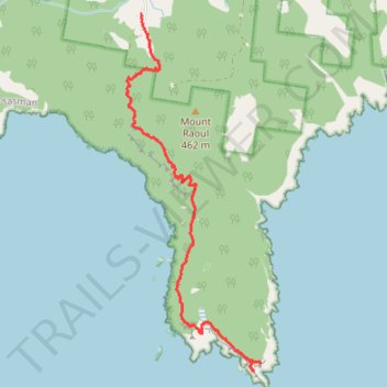
Name: Car park to Cape Raul trail, distance, elevation, map, profile, GPS track
Start: Stormlea Road, Stormlea, Tasmania, 7184, Australia (-43.19410 147.77685)
End: Seal Lookout, Cape Raoul Track, Tasmania, Australia (-43.23833 147.79755)
Coordinates: -43.23944 147.77431 -43.19410 147.79758