
10 Day Jacks trace
- Distance: 6.5 mi
- Elevation gain: 364 m
- Maximum elevation: 2,538 m
- Elevation loss: 363 m
- Minimum elevation: 2,282 m
- Moving time: 2 h 11 m
- Moving speed: 3.0 mph
- Maximum speed: 7.6 mph
- Total time: 3 h 18 m
- Global speed: 2.0 mph
Interactive trail map
Trail profile
- Distance: 6.5 mi
- Elevation gain: 364 m
- Maximum elevation: 2,538 m
- Elevation loss: 363 m
- Minimum elevation: 2,282 m
- Moving time: 2 h 11 m
- Moving speed: 3.0 mph
- Maximum speed: 7.6 mph
- Total time: 3 h 18 m
- Global speed: 2.0 mph
About this trail
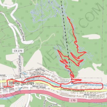
Name: 10 Day Jacks trace trail, distance, elevation, map, profile, GPS track
Coordinates: 39.74164 -105.51660 39.75109 -105.49995