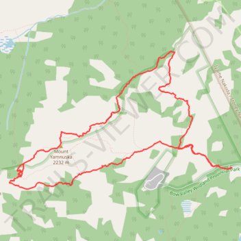
Mount Yamnuska Loop Hike
- Distance: 6.9 mi
- Elevation gain: 1,057 m
- Maximum elevation: 2,207 m
- Elevation loss: 1,057 m
- Minimum elevation: 1,347 m
- Moving time: 3 h 2 m
- Moving speed: 2.3 mph
- Maximum speed: 10.1 mph
- Total time: 4 h 47 m
- Global speed: 1.4 mph
Interactive trail map
Trail profile
- Distance: 6.9 mi
- Elevation gain: 1,057 m
- Maximum elevation: 2,207 m
- Elevation loss: 1,057 m
- Minimum elevation: 1,347 m
- Moving time: 3 h 2 m
- Moving speed: 2.3 mph
- Maximum speed: 10.1 mph
- Total time: 4 h 47 m
- Global speed: 1.4 mph
About this trail
Name: Mount Yamnuska Loop Hike trail, distance, elevation, map, profile, GPS track
Coordinates: 51.11859 -115.12769 51.13463 -115.08632