Boucle du Lion
- Distance: 12.9 mi
- Elevation gain: 106 m
- Maximum elevation: 26 m
- Elevation loss: 102 m
- Minimum elevation: 7 m
Interactive trail map
Trail profile
- Distance: 12.9 mi
- Elevation gain: 106 m
- Maximum elevation: 26 m
- Elevation loss: 102 m
- Minimum elevation: 7 m
About this trail
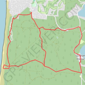
Name: Boucle du Lion trail, distance, elevation, map, profile, GPS track
Coordinates: 44.95932 -1.20568 44.99400 -1.14246
Other hiking, mountain biking, running and outdoor activity trails
Click on a trail to view its statistics, map and profile.
Chemin de Saint-Jacques-de-Compostelle
Switzerland > Geneva > Geneva
Distance: 694.6 mi • Elevation gain: 25,262 m • Maximum elevation: 1,430 m