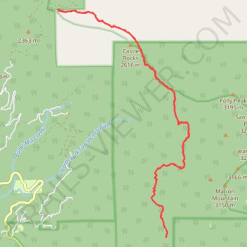
PCT from Black Mountain Road to Strawberry Junction
Pacific Crest National Scenic Trail (PCT)
- Distance: 14.8 mi
- Elevation gain: 1,098 m
- Maximum elevation: 2,740 m
- Elevation loss: 1,098 m
- Minimum elevation: 2,357 m
- Moving time: 7 h 8 m
- Moving speed: 2.1 mph
- Maximum speed: 3.6 mph
- Total time: 9 h 23 m
- Global speed: 1.6 mph
Interactive trail map
Trail profile
- Distance: 14.8 mi
- Elevation gain: 1,098 m
- Maximum elevation: 2,740 m
- Elevation loss: 1,098 m
- Minimum elevation: 2,357 m
- Moving time: 7 h 8 m
- Moving speed: 2.1 mph
- Maximum speed: 3.6 mph
- Total time: 9 h 23 m
- Global speed: 1.6 mph
About this trail
Name: PCT from Black Mountain Road to Strawberry Junction trail, distance, elevation, map, profile, GPS track
End: Fuller Spur C, Riverside County, California, United States (33.83892 -116.73620)
Coordinates: 33.78290 -116.73647 33.83931 -116.69737
Other hiking, mountain biking, running and outdoor activity trails
Click on a trail to view its statistics, map and profile.
Pacific Crest Trail (PCT) through San Bernardino Forest and Santa Rosa and San Jacinto Mountains
United States > California > Riverside County
Hike from Bull Canyon Parking to Snow Creek along the Pacific Crest National Scenic Trail via Lion Peak, Pyramid Peak, Cedar Spring, Palm View Peak, Fobes Saddle, Spitler Peak, Apache Peak, Apache Spring, Antsell Rock, South Peak, Red Tahquitz, Tahquitz Meadow, Powderbox Spring, Middle Spring, Jolley Spring,…
Distance: 59.0 mi • Elevation gain: 3,982 m • Maximum elevation: 2,737 m
Mount Jacinto Loop
United States > California > Riverside County > Idyllwild
Loop Hike to Mount Jacinto via Deer Springs Trail, Pacific Crest Trail (PCT), Peak Trail and Wellman's Cienaga Trail in the San Bernardino National Forest and the Mount San Jacinto State Park. #Hiking #Loop #Mountain #Nature #Forest #Park #PCT
Distance: 17.4 mi • Elevation gain: 1,646 m • Maximum elevation: 3,279 m