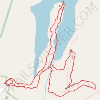
Short loop walk at Opacum Woods via Perry's Point
- Distance: 1.1 mi
- Elevation gain: 13 m
- Maximum elevation: 209 m
- Elevation loss: 13 m
- Minimum elevation: 202 m
- Moving time: 39 m 40 s
- Moving speed: 1.7 mph
- Maximum speed: 4.5 mph
- Total time: 45 m 3 s
- Global speed: 1.5 mph
Interactive trail map
Trail profile
- Distance: 1.1 mi
- Elevation gain: 13 m
- Maximum elevation: 209 m
- Elevation loss: 13 m
- Minimum elevation: 202 m
- Moving time: 39 m 40 s
- Moving speed: 1.7 mph
- Maximum speed: 4.5 mph
- Total time: 45 m 3 s
- Global speed: 1.5 mph
About this trail
Name: Short loop walk at Opacum Woods via Perry's Point trail, distance, elevation, map, profile, GPS track
End: White Trail, Sturbridge, Worcester County, Massachusetts, 01566, United States (42.12489 -72.07780)
Coordinates: 42.12444 -72.07780 42.12768 -72.07348