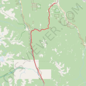
Boston Bar - Spences Bridge
Fraser River. #Bike
- Distance: 47.8 mi
- Elevation gain: 1,228 m
- Maximum elevation: 365 m
- Elevation loss: 1,197 m
- Minimum elevation: 184 m
Interactive trail map
Trail profile
- Distance: 47.8 mi
- Elevation gain: 1,228 m
- Maximum elevation: 365 m
- Elevation loss: 1,197 m
- Minimum elevation: 184 m
About this trail
Name: Boston Bar - Spences Bridge trail, distance, elevation, map, profile, GPS track
Coordinates: 49.91314 -121.57877 50.42563 -121.33397
Other hiking, mountain biking, running and outdoor activity trails
Click on a trail to view its statistics, map and profile.
Spences Bridge - Cache Creek
Canada > British Columbia > Thompson-Nicola Regional District > Area I (Blue Sky Country) > Spences Bridge
Thompson River. #Bike #SpencesBridge #CacheCreek #Thompson
Distance: 30.3 mi • Elevation gain: 698 m • Maximum elevation: 512 m