Make a donation
Gear up for your next adventure:
As an Amazon Associate, this site earns from qualifying purchases at no extra cost to you.
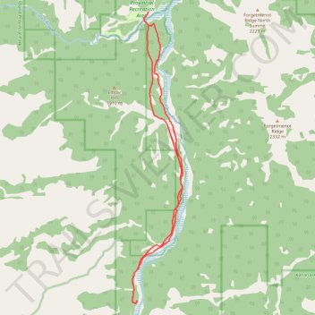
Little Elbow to Big Elbow Campground
- Distance: 11.5 mi
- Elevation gain: 195 m
- Maximum elevation: 1,729 m
- Elevation loss: 196 m
- Minimum elevation: 1,610 m
- Moving time: 2 h 55 m
- Moving speed: 3.9 mph
- Maximum speed: 11.0 mph
- Total time: 3 h 14 m
- Global speed: 3.5 mph
Interactive trail map
Make a donation
Gear up for your next adventure:
As an Amazon Associate, this site earns from qualifying purchases at no extra cost to you.
Trail profile
- Distance: 11.5 mi
- Elevation gain: 195 m
- Maximum elevation: 1,729 m
- Elevation loss: 196 m
- Minimum elevation: 1,610 m
- Moving time: 2 h 55 m
- Moving speed: 3.9 mph
- Maximum speed: 11.0 mph
- Total time: 3 h 14 m
- Global speed: 3.5 mph
Make a donation
Gear up for your next adventure:
As an Amazon Associate, this site earns from qualifying purchases at no extra cost to you.
About this trail
Name: Little Elbow to Big Elbow Campground trail, distance, elevation, map, profile, GPS track
Coordinates: 50.72391 -114.86045 50.79437 -114.84105
Make a donation
Gear up for your next adventure:
As an Amazon Associate, this site earns from qualifying purchases at no extra cost to you.
Other hiking, mountain biking, running and outdoor activity trails
Click on a trail to view its statistics, map and profile.
Elbow River - Forgetmenot Ridge - Forgetmenot Mountain
Canada > Alberta > Kananaskis Improvement District
Distance: 6.2 mi • Elevation gain: 968 m • Maximum elevation: 2,326 m
Little Elbow to Mount Romulus Campground
Canada > Alberta > Kananaskis Improvement District
Distance: 15.4 mi • Elevation gain: 371 m • Maximum elevation: 1,811 m
12-OCT-21 16:57:46
Canada > Alberta > Kananaskis Improvement District
Distance: 16.5 mi • Elevation gain: 1,078 m • Maximum elevation: 2,329 m