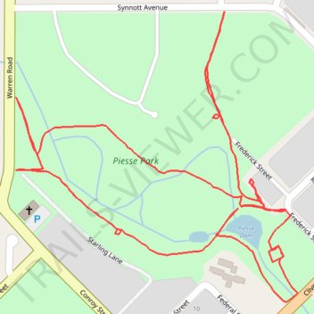
Piesse Park paved paths
- Distance: 1.6 mi
- Elevation gain: 10 m
- Maximum elevation: 313 m
- Elevation loss: 9 m
- Minimum elevation: 307 m
- Moving time: 29 m 24 s
- Moving speed: 3.2 mph
- Maximum speed: 3.9 mph
- Total time: 29 m 24 s
- Global speed: 3.2 mph
Interactive trail map
Trail profile
- Distance: 1.6 mi
- Elevation gain: 10 m
- Maximum elevation: 313 m
- Elevation loss: 9 m
- Minimum elevation: 307 m
- Moving time: 29 m 24 s
- Moving speed: 3.2 mph
- Maximum speed: 3.9 mph
- Total time: 29 m 24 s
- Global speed: 3.2 mph
About this trail
Name: Piesse Park paved paths trail, distance, elevation, map, profile, GPS track
Coordinates: -33.68621 117.55596 -33.68201 117.56087