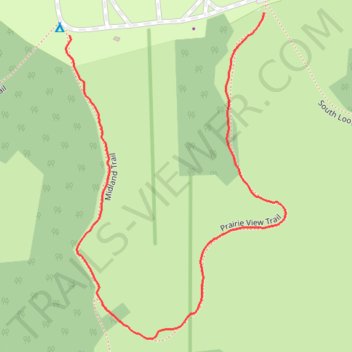
Prairie View Trail loop
- Distance: 0.6 mi
- Elevation gain: 10 m
- Maximum elevation: 219 m
- Elevation loss: 10 m
- Minimum elevation: 212 m
- Moving time: 30 m 4 s
- Moving speed: 1.3 mph
- Maximum speed: 2.5 mph
- Total time: 37 m 50 s
- Global speed: 1.0 mph
Interactive trail map
Trail profile
- Distance: 0.6 mi
- Elevation gain: 10 m
- Maximum elevation: 219 m
- Elevation loss: 10 m
- Minimum elevation: 212 m
- Moving time: 30 m 4 s
- Moving speed: 1.3 mph
- Maximum speed: 2.5 mph
- Total time: 37 m 50 s
- Global speed: 1.0 mph
About this trail
Name: Prairie View Trail loop trail, distance, elevation, map, profile, GPS track
Start: Prairie View Trail, Champaign County, Illinois, United States (40.37607 -87.95938)
End: South Loop Trail, Champaign County, Illinois, United States (40.37582 -87.96224)
Coordinates: 40.37241 -87.96229 40.37607 -87.95905