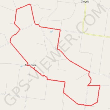
Wheatlands to Wooroonden
Wheatlands, Byee, Silverleaf, Wooroonden, Marshlands, Mondure, Queensland
- Distance: 26.5 mi
- Elevation gain: 180 m
- Maximum elevation: 308 m
- Elevation loss: 180 m
- Minimum elevation: 262 m
- Moving time: 2 h 4 m
- Moving speed: 12.8 mph
- Maximum speed: 24.2 mph
- Total time: 2 h 19 m
- Global speed: 11.4 mph
Interactive trail map
Trail profile
- Distance: 26.5 mi
- Elevation gain: 180 m
- Maximum elevation: 308 m
- Elevation loss: 180 m
- Minimum elevation: 262 m
- Moving time: 2 h 4 m
- Moving speed: 12.8 mph
- Maximum speed: 24.2 mph
- Total time: 2 h 19 m
- Global speed: 11.4 mph
About this trail
Name: Wheatlands to Wooroonden trail, distance, elevation, map, profile, GPS track
Coordinates: -26.22763 151.74941 -26.11108 151.86412
Other hiking, mountain biking, running and outdoor activity trails
Click on a trail to view its statistics, map and profile.
Ficks Crossing to Hivesville
Australia > Queensland > Wheatlands
Ficks Crossing, Wheatlands, Silverleaf, Marshlands, Hivesville, Leafdale, Keysland, Chelmsford, Queensland
Distance: 34.0 mi • Elevation gain: 395 m • Maximum elevation: 433 m
Ficks Crossing to Mount McEuen Queensland
Australia > Queensland > Ficks Crossing
Ficks Crossing, Wheatlands, Vhelmsford, Leafdale, Keysland, Mt McEuen, Fairdale, Queensland
Distance: 28.8 mi • Elevation gain: 401 m • Maximum elevation: 417 m
Murgon to Cloyna via Boat Mountain
Australia > Queensland > Murgon
Murgon, Tablelends, Merlwood, Warnung, Cloyna, Byee, Barlil, Queensland
Distance: 32.9 mi • Elevation gain: 651 m • Maximum elevation: 512 m
Byee to Greenview, Cushnie and Mondure
Australia > Queensland > Byee
Distance: 34.3 mi • Elevation gain: 381 m • Maximum elevation: 469 m
Leafdale to Stonelands
Leafdale, Mondure, Marshlands, Wooroonden, Stonelenda, Hivesville, Keysland, Queensland
Distance: 28.0 mi • Elevation gain: 354 m • Maximum elevation: 434 m
Murgon to Byee and back via Merlwood
Australia > Queensland > Murgon
Distance: 25.3 mi • Elevation gain: 352 m • Maximum elevation: 352 m
Mondure to Windera Park
Mondure, Silverleaf, Warnung, Cloyna, Kitoba, Windera, Glenrock
Distance: 34.6 mi • Elevation gain: 324 m • Maximum elevation: 307 m
Byee Wheatlands
Byee, Wheatlands, Ficks Crossing, Queensland
Distance: 15.2 mi • Elevation gain: 101 m • Maximum elevation: 345 m