Camp Osito Road
San Bernardino National Forest. #Hiking #SanBernardino
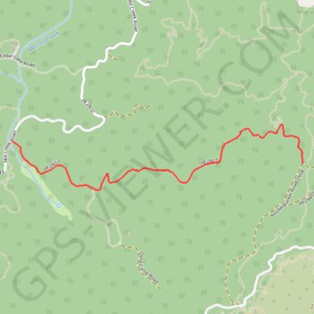
- Distance: 1.8 mi
- Elevation gain: 132 m
- Maximum elevation: 2,321 m
- Elevation loss: 47 m
- Minimum elevation: 2,235 m
- Moving time: 1 h 5 m
- Moving speed: 1.6 mph
- Maximum speed: 3.2 mph
- Total time: 1 h 9 m
- Global speed: 1.5 mph
Interactive trail map
Trail profile
- Distance: 1.8 mi
- Elevation gain: 132 m
- Maximum elevation: 2,321 m
- Elevation loss: 47 m
- Minimum elevation: 2,235 m
- Moving time: 1 h 5 m
- Moving speed: 1.6 mph
- Maximum speed: 3.2 mph
- Total time: 1 h 9 m
- Global speed: 1.5 mph
About this trail
Name: Camp Osito Road trail, distance, elevation, map, profile, GPS track
Coordinates: 34.22209 -116.93913 34.22603 -116.91811
Other hiking, mountain biking, running and outdoor activity trails
Click on a trail to view its statistics, map and profile.
Grand View Point
United States > California > San Bernardino County
Starting near Aspen Glen on the south side of Big Bear Lake, the Pine Knot Trail climbs steadily through oak, pine and wildflower forest, with occasional openings back toward the lake. The route continues past the Red Ant Canyon area, crosses forest roads and passes Deer Group Camp before joining the approach…
Distance: 3.5 mi • Elevation gain: 313 m • Maximum elevation: 2,349 m
Big Bear - San Bernardino National Forest
United States > California > San Bernardino County
Distance: 23.1 mi • Elevation gain: 1,048 m • Maximum elevation: 2,413 m