Kiwanis Park trails
- Distance: 2.2 mi
- Elevation gain: 7 m
- Maximum elevation: 7 m
- Elevation loss: 8 m
- Minimum elevation: 4 m
Interactive trail map
Trail profile
- Distance: 2.2 mi
- Elevation gain: 7 m
- Maximum elevation: 7 m
- Elevation loss: 8 m
- Minimum elevation: 4 m
About this trail
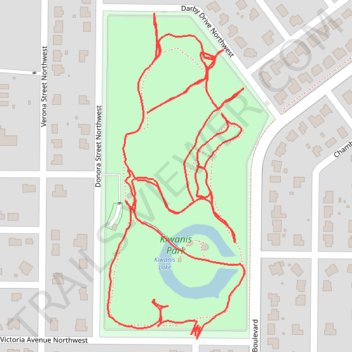
Name: Kiwanis Park trails trail, distance, elevation, map, profile, GPS track
Coordinates: 26.98236 -82.13341 26.98726 -82.13110