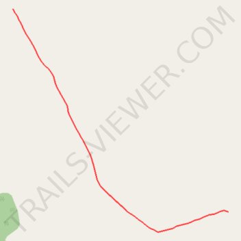
Dog Leg on Outer Grazing Fence Trail
- Distance: 0.5 mi
- Elevation gain: 43 m
- Maximum elevation: 680 m
- Elevation loss: 12 m
- Minimum elevation: 637 m
- Moving time: 11 m 47 s
- Moving speed: 2.6 mph
- Maximum speed: 3.1 mph
- Total time: 11 m 47 s
- Global speed: 2.6 mph
Interactive trail map
Trail profile
- Distance: 0.5 mi
- Elevation gain: 43 m
- Maximum elevation: 680 m
- Elevation loss: 12 m
- Minimum elevation: 637 m
- Moving time: 11 m 47 s
- Moving speed: 2.6 mph
- Maximum speed: 3.1 mph
- Total time: 11 m 47 s
- Global speed: 2.6 mph
About this trail
Name: Dog Leg on Outer Grazing Fence Trail trail, distance, elevation, map, profile, GPS track
Start: Yukon, Canada (61.10079 -135.22247)
End: Yukon, Canada (61.10515 -135.23203)
Coordinates: 61.10036 -135.23203 61.10515 -135.22247
Other hiking, mountain biking, running and outdoor activity trails
Click on a trail to view its statistics, map and profile.
Mt Bike Ride - Lake Laberge
Distance: 10.2 mi • Elevation gain: 218 m • Maximum elevation: 717 m
Laberge Mt Bike Ride
Distance: 11.6 mi • Elevation gain: 313 m • Maximum elevation: 736 m