
RE SE910050
- Distance: 1.8 mi
- Elevation gain: 10 m
- Maximum elevation: 22 m
- Elevation loss: 9 m
- Minimum elevation: 18 m
Interactive trail map
Trail profile
- Distance: 1.8 mi
- Elevation gain: 10 m
- Maximum elevation: 22 m
- Elevation loss: 9 m
- Minimum elevation: 18 m
About this trail
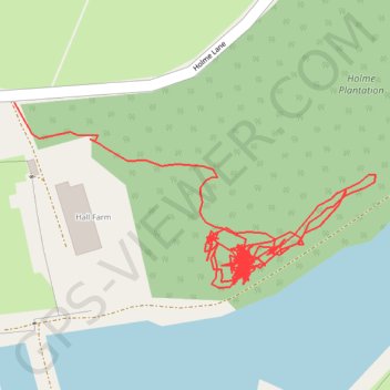
Name: RE SE910050 trail, distance, elevation, map, profile, GPS track
Coordinates: 53.53415 -0.63170 53.53595 -0.62581
Topography: North Lincolnshire topographic map, elevation, terrain
Other hiking, mountain biking, running and outdoor activity trails
Click on a trail to view its statistics, map and profile.
Gravel ride loop from Sheffield to Hornsea and York
United Kingdom > England > Sheffield
Distance: 207.1 mi • Elevation gain: 1,836 m • Maximum elevation: 222 m