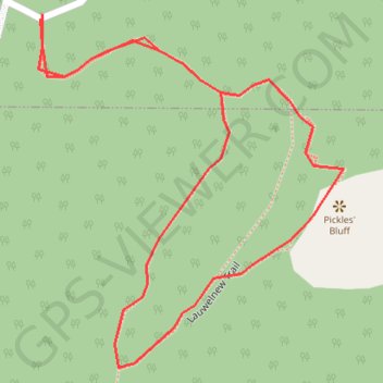
Mount Newton - Pickles' Bluff Loop
Interactive trail map
Trail profile
- Distance: 0.4 mi
- Elevation gain: 46 m
- Maximum elevation: 298 m
- Elevation loss: 46 m
- Minimum elevation: 252 m
About this trail
Name: Mount Newton - Pickles' Bluff Loop trail, distance, elevation, map, profile, GPS track
Coordinates: 48.61122 -123.44348 48.61257 -123.44172
Other hiking, mountain biking, running and outdoor activity trails
Click on a trail to view its statistics, map and profile.
BBF loop to the Skydeck in Nanaimo
Canada > British Columbia > Cowichan Valley Regional District > Area A (Mill Bay / Malahat) > Mill Bay
BBF loop to the Skydeck
Distance: 201.0 mi • Elevation gain: 6,222 m • Maximum elevation: 706 m