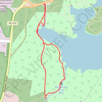
Long Lake Provincial Park - Pipeline Loop
#Hiking #Wilderness #Backcountry
- Distance: 2.2 mi
- Elevation gain: 38 m
- Maximum elevation: 92 m
- Elevation loss: 38 m
- Minimum elevation: 63 m
- Moving time: 1 h 47 s
- Moving speed: 2.2 mph
- Maximum speed: 3.7 mph
- Total time: 1 h 24 m
- Global speed: 1.6 mph
Interactive trail map
Trail profile
- Distance: 2.2 mi
- Elevation gain: 38 m
- Maximum elevation: 92 m
- Elevation loss: 38 m
- Minimum elevation: 63 m
- Moving time: 1 h 47 s
- Moving speed: 2.2 mph
- Maximum speed: 3.7 mph
- Total time: 1 h 24 m
- Global speed: 1.6 mph
About this trail
Name: Long Lake Provincial Park - Pipeline Loop trail, distance, elevation, map, profile, GPS track
Coordinates: 44.62009 -63.65951 44.63224 -63.65435