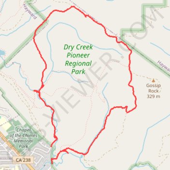
Dry Creek Pioneer Regional Park Loop Hike
- Distance: 5.4 mi
- Elevation gain: 352 m
- Maximum elevation: 356 m
- Elevation loss: 338 m
- Minimum elevation: 38 m
- Moving time: 2 h 5 m
- Moving speed: 2.6 mph
- Maximum speed: 5.4 mph
- Total time: 2 h 25 m
- Global speed: 2.2 mph
Interactive trail map
Trail profile
- Distance: 5.4 mi
- Elevation gain: 352 m
- Maximum elevation: 356 m
- Elevation loss: 338 m
- Minimum elevation: 38 m
- Moving time: 2 h 5 m
- Moving speed: 2.6 mph
- Maximum speed: 5.4 mph
- Total time: 2 h 25 m
- Global speed: 2.2 mph
About this trail
Name: Dry Creek Pioneer Regional Park Loop Hike trail, distance, elevation, map, profile, GPS track
Coordinates: 37.60820 -122.02114 37.63155 -122.00195