Retreat road
Evening Walk
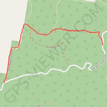
- Distance: 1.6 mi
- Elevation gain: 109 m
- Maximum elevation: 221 m
- Elevation loss: 67 m
- Minimum elevation: 115 m
- Moving time: 37 m 43 s
- Moving speed: 2.6 mph
- Maximum speed: 5.8 mph
- Total time: 38 m 46 s
- Global speed: 2.5 mph
Interactive trail map
Trail profile
- Distance: 1.6 mi
- Elevation gain: 109 m
- Maximum elevation: 221 m
- Elevation loss: 67 m
- Minimum elevation: 115 m
- Moving time: 37 m 43 s
- Moving speed: 2.6 mph
- Maximum speed: 5.8 mph
- Total time: 38 m 46 s
- Global speed: 2.5 mph
About this trail
Name: Retreat road trail, distance, elevation, map, profile, GPS track
Coordinates: -30.21115 153.04088 -30.20296 153.05675