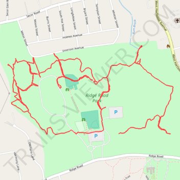
Ridge Road Park
- Distance: 4.1 mi
- Elevation gain: 65 m
- Maximum elevation: 125 m
- Elevation loss: 67 m
- Minimum elevation: 99 m
- Moving time: 1 h 14 m
- Moving speed: 3.3 mph
- Maximum speed: 12.1 mph
- Total time: 1 h 16 m
- Global speed: 3.2 mph
Interactive trail map
Trail profile
- Distance: 4.1 mi
- Elevation gain: 65 m
- Maximum elevation: 125 m
- Elevation loss: 67 m
- Minimum elevation: 99 m
- Moving time: 1 h 14 m
- Moving speed: 3.3 mph
- Maximum speed: 12.1 mph
- Total time: 1 h 16 m
- Global speed: 3.2 mph
About this trail
Name: Ridge Road Park trail, distance, elevation, map, profile, GPS track
Coordinates: 41.02184 -73.81933 41.02661 -73.80748
Other hiking, mountain biking, running and outdoor activity trails
Click on a trail to view its statistics, map and profile.