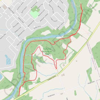
Komoka Provincial Park
Interactive trail map
Trail profile
- Distance: 4.9 mi
- Elevation gain: 99 m
- Maximum elevation: 271 m
- Elevation loss: 99 m
- Minimum elevation: 217 m
About this trail
Name: Komoka Provincial Park trail, distance, elevation, map, profile, GPS track
Start: Blue Trail, Middlesex Centre, Middlesex County, Ontario, N0L 1R0, Canada (42.94557 -81.39365)
End: Blue Trail, Middlesex Centre, Middlesex County, Ontario, N0L 1R0, Canada (42.94557 -81.39365)
Coordinates: 42.93967 -81.40516 42.95960 -81.38598