Import a GPX file

Port Moody - Shoreline Trail

Burrard Inlet. #Hiking #Bike #Running

  • Distance: 3.6 mi
  • Elevation gain: 78 m
  • Maximum elevation: 15 m
  • Elevation loss: 78 m
  • Minimum elevation: 0 m

Interactive trail map

Trail profile

  • Distance: 3.6 mi
  • Elevation gain: 78 m
  • Maximum elevation: 15 m
  • Elevation loss: 78 m
  • Minimum elevation: 0 m

About this trail

Other hiking, mountain biking, running and outdoor activity trails

Click on a trail to view its statistics, map and profile.
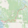
Vancouver - Golden

Canada > British Columbia > Metro Vancouver Regional District > Vancouver

#Bike #Vancouver #Golden

Distance: 514.2 mi • Elevation gain: 9,376 m • Maximum elevation: 1,347 m

Gear up for your next adventure:

🔦LED Camping Lanterns - Illumination for reading maps inside your tent at night
🚲Cycling GPS Computers - Track elevation and topographic routes on two wheels
🧥Softshell Jackets - Breathable jackets for active outdoor use
🛑Emergency Bivvy Bags - Heat-reflective survival bags for unexpected nights out
🧭GPS Trackers - Tracking devices for safety and navigation

As an Amazon Associate, this site earns from qualifying purchases at no extra cost to you.