
Cycle around Enfield from Forty Hall to Trent Park
- Distance: 10.7 mi
- Elevation gain: 162 m
- Maximum elevation: 103 m
- Elevation loss: 160 m
- Minimum elevation: 27 m
- Moving time: 1 h 14 m
- Moving speed: 8.6 mph
- Maximum speed: 20.0 mph
- Total time: 1 h 17 m
- Global speed: 8.3 mph
Interactive trail map
Trail profile
- Distance: 10.7 mi
- Elevation gain: 162 m
- Maximum elevation: 103 m
- Elevation loss: 160 m
- Minimum elevation: 27 m
- Moving time: 1 h 14 m
- Moving speed: 8.6 mph
- Maximum speed: 20.0 mph
- Total time: 1 h 17 m
- Global speed: 8.3 mph
About this trail
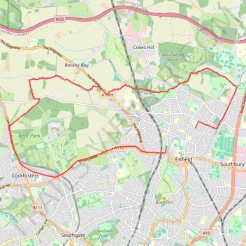
Name: Cycle around Enfield from Forty Hall to Trent Park trail, distance, elevation, map, profile, GPS track
Coordinates: 51.64717 -0.15397 51.67561 -0.05865
Topography: Greater London topographic map, elevation, terrain