Thank you for supporting this site ❤️
Make a donation
Make a donation
Gear up for your next adventure:
As an Amazon Associate, this site earns from qualifying purchases at no extra cost to you.
Trails, Sooke hills, Sooke, BC, Canada
- Distance: 12.3 mi
- Elevation gain: 744 m
- Maximum elevation: 571 m
- Elevation loss: 516 m
- Minimum elevation: 84 m
- Moving time: 3 h 53 m
- Moving speed: 3.1 mph
- Maximum speed: 19.0 mph
- Total time: 6 h 37 m
- Global speed: 1.9 mph
Interactive trail map
Thank you for supporting this site ❤️
Make a donation
Make a donation
Gear up for your next adventure:
As an Amazon Associate, this site earns from qualifying purchases at no extra cost to you.
Trail profile
- Distance: 12.3 mi
- Elevation gain: 744 m
- Maximum elevation: 571 m
- Elevation loss: 516 m
- Minimum elevation: 84 m
- Moving time: 3 h 53 m
- Moving speed: 3.1 mph
- Maximum speed: 19.0 mph
- Total time: 6 h 37 m
- Global speed: 1.9 mph
Thank you for supporting this site ❤️
Make a donation
Make a donation
Gear up for your next adventure:
As an Amazon Associate, this site earns from qualifying purchases at no extra cost to you.
About this trail
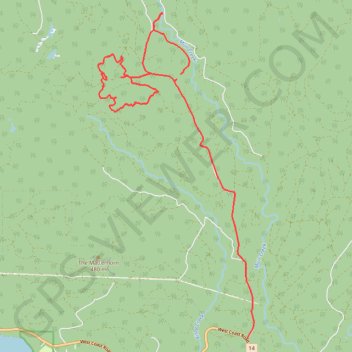
Name: Trails, Sooke hills, Sooke, BC, Canada trail, distance, elevation, map, profile, GPS track
Coordinates: 48.39535 -123.92511 48.46292 -123.87634
Thank you for supporting this site ❤️
Make a donation
Make a donation
Gear up for your next adventure:
As an Amazon Associate, this site earns from qualifying purchases at no extra cost to you.