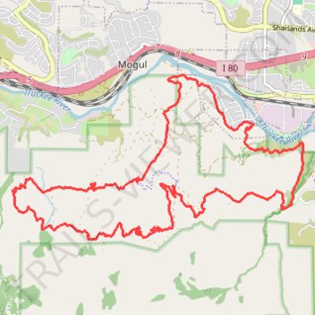
Hunter Footill Road Loop in Humboldt-Toiyabe National Forest
- Distance: 13.1 mi
- Elevation gain: 548 m
- Maximum elevation: 1,720 m
- Elevation loss: 549 m
- Minimum elevation: 1,420 m
- Moving time: 3 h 5 m
- Moving speed: 4.2 mph
- Maximum speed: 8.5 mph
- Total time: 3 h 14 m
- Global speed: 4.0 mph
Interactive trail map
Trail profile
- Distance: 13.1 mi
- Elevation gain: 548 m
- Maximum elevation: 1,720 m
- Elevation loss: 549 m
- Minimum elevation: 1,420 m
- Moving time: 3 h 5 m
- Moving speed: 4.2 mph
- Maximum speed: 8.5 mph
- Total time: 3 h 14 m
- Global speed: 4.0 mph
About this trail
Name: Hunter Footill Road Loop in Humboldt-Toiyabe National Forest trail, distance, elevation, map, profile, GPS track
Start: Hunter Creek Trail, Washoe County, Nevada, 89523, United States (39.49277 -119.89507)
End: Hunter Creek Trail, Washoe County, Nevada, 89523, United States (39.49289 -119.89495)
Coordinates: 39.48754 -119.94923 39.51217 -119.89282
Other hiking, mountain biking, running and outdoor activity trails
Click on a trail to view its statistics, map and profile.
Hunter Creek Trail in Mount Rose Wilderness
United States > Nevada > Washoe County
The Hunter Creek Trail is a delightful hike that takes you through diverse landscapes. Starting out under the open sun, the trail quickly transitions into a serene forest where you can enjoy the nature leading up to a stunning waterfall. This peaceful spot is perfect for a break, making the hike a rewarding…
Distance: 6.1 mi • Elevation gain: 403 m • Maximum elevation: 1,878 m
Day 1: Home to dispersed camping 60 mi E of Austin, NV
United States > Nevada > Washoe County > Reno
Distance: 129.5 mi • Elevation gain: 1,012 m • Maximum elevation: 1,563 m