Import a GPX file

Walking around Lake Temescal

  • Distance: 1.4 mi
  • Elevation gain: 46 m
  • Maximum elevation: 158 m
  • Elevation loss: 46 m
  • Minimum elevation: 131 m
  • Moving time: 28 m 54 s
  • Moving speed: 3.0 mph
  • Maximum speed: 5.9 mph
  • Total time: 31 m 52 s
  • Global speed: 2.7 mph

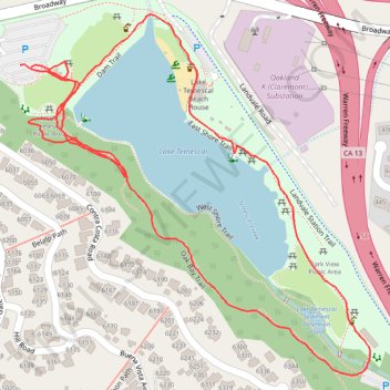
Interactive trail map

Trail profile

  • Distance: 1.4 mi
  • Elevation gain: 46 m
  • Maximum elevation: 158 m
  • Elevation loss: 46 m
  • Minimum elevation: 131 m
  • Moving time: 28 m 54 s
  • Moving speed: 3.0 mph
  • Maximum speed: 5.9 mph
  • Total time: 31 m 52 s
  • Global speed: 2.7 mph

About this trail

Name: Walking around Lake Temescal trail, distance, elevation, map, profile, GPS track

Start: Broadway, Upper Rockridge, Oakland, Alameda County, California, 94618, United States (37.84763 -122.23314)

End: Broadway, Upper Rockridge, Oakland, Alameda County, California, 94618, United States (37.84761 -122.23295)

Coordinates: 37.84351 -122.23314 37.84830 -122.22726

Gear up for your next adventure:

🚶Walking Pedometers - Simple distance tracking for casual trail walkers
🧭GPS Trackers - Tracking devices for safety and navigation
🧢Thermal Beanie Hats - Prevent heat loss from the head in windy summit conditions
🎒Hiking Daypacks (20L) - Compact backpacks for day trips and technical mountain ascents
🎒Replacement Sternum Straps - Repair parts for hiking rucksacks

As an Amazon Associate, this site earns from qualifying purchases at no extra cost to you.