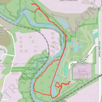
Ohio & Erie Canal Towpath Trail
- Distance: 3.4 mi
- Elevation gain: 52 m
- Maximum elevation: 195 m
- Elevation loss: 52 m
- Minimum elevation: 177 m
- Moving time: 1 h 20 m
- Moving speed: 2.5 mph
- Maximum speed: 3.4 mph
- Total time: 1 h 31 m
- Global speed: 2.2 mph
Interactive trail map
Trail profile
- Distance: 3.4 mi
- Elevation gain: 52 m
- Maximum elevation: 195 m
- Elevation loss: 52 m
- Minimum elevation: 177 m
- Moving time: 1 h 20 m
- Moving speed: 2.5 mph
- Maximum speed: 3.4 mph
- Total time: 1 h 31 m
- Global speed: 2.2 mph
About this trail
Name: Ohio & Erie Canal Towpath Trail trail, distance, elevation, map, profile, GPS track
Coordinates: 41.42798 -81.66928 41.44107 -81.66208