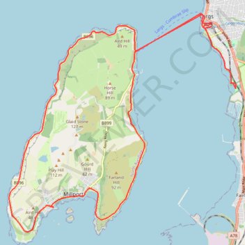
Around Great Cumbrae
Bike
- Distance: 16.1 mi
- Elevation gain: 137 m
- Maximum elevation: 18 m
- Elevation loss: 137 m
- Minimum elevation: 0 m
- Moving time: 2 h 40 m
- Moving speed: 6.0 mph
- Maximum speed: 16.2 mph
- Total time: 7 h 56 m
- Global speed: 2.0 mph
Interactive trail map
Trail profile
- Distance: 16.1 mi
- Elevation gain: 137 m
- Maximum elevation: 18 m
- Elevation loss: 137 m
- Minimum elevation: 0 m
- Moving time: 2 h 40 m
- Moving speed: 6.0 mph
- Maximum speed: 16.2 mph
- Total time: 7 h 56 m
- Global speed: 2.0 mph
About this trail
Name: Around Great Cumbrae trail, distance, elevation, map, profile, GPS track
Coordinates: 55.74522 -4.95013 55.79556 -4.85738
Topography: North Ayrshire topographic map, elevation, terrain
Other hiking, mountain biking, running and outdoor activity trails
Click on a trail to view its statistics, map and profile.
Fairlie to Largs Walk
United Kingdom > Scotland > North Ayrshire > Fairlie
Clyde Muirshiel Regional Park
Distance: 5.7 mi • Elevation gain: 47 m • Maximum elevation: 16 m
Irvine, Scotland to Largs and back
United Kingdom > Scotland > North Ayrshire > Irvine
Morning Bike Ride
Distance: 41.6 mi • Elevation gain: 324 m • Maximum elevation: 35 m