Righetti Hill Hike
- Distance: 3.5 mi
- Elevation gain: 127 m
- Maximum elevation: 166 m
- Elevation loss: 127 m
- Minimum elevation: 64 m
- Moving time: 1 h 17 m
- Moving speed: 2.7 mph
- Maximum speed: 4.2 mph
- Total time: 1 h 38 m
- Global speed: 2.1 mph
Interactive trail map
Trail profile
- Distance: 3.5 mi
- Elevation gain: 127 m
- Maximum elevation: 166 m
- Elevation loss: 127 m
- Minimum elevation: 64 m
- Moving time: 1 h 17 m
- Moving speed: 2.7 mph
- Maximum speed: 4.2 mph
- Total time: 1 h 38 m
- Global speed: 2.1 mph
About this trail
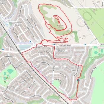
Name: Righetti Hill Hike trail, distance, elevation, map, profile, GPS track
Coordinates: 35.24469 -120.63476 35.25441 -120.62727