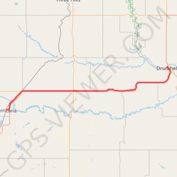
Irricana - Drumheller
- Distance: 46.6 mi
- Elevation gain: 314 m
- Maximum elevation: 942 m
- Elevation loss: 561 m
- Minimum elevation: 684 m
Interactive trail map
Trail profile
- Distance: 46.6 mi
- Elevation gain: 314 m
- Maximum elevation: 942 m
- Elevation loss: 561 m
- Minimum elevation: 684 m
About this trail
Name: Irricana - Drumheller trail, distance, elevation, map, profile, GPS track
Start: 300, 1st Street, Town of Irricana, Alberta, T0M 1B0, Canada (51.32325 -113.60644)
End: Willow Avenue, North Drumheller, Drumheller, Alberta, T0J 0Y3, Canada (51.46854 -112.71473)
Coordinates: 51.32129 -113.60644 51.47001 -112.70057
Other hiking, mountain biking, running and outdoor activity trails
Click on a trail to view its statistics, map and profile.