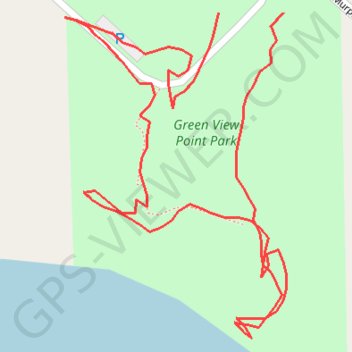
Lyons Green View Point Park
- Distance: 0.5 mi
- Elevation gain: 35 m
- Maximum elevation: 235 m
- Elevation loss: 37 m
- Minimum elevation: 202 m
- Moving time: 17 m 12 s
- Moving speed: 1.6 mph
- Maximum speed: 5.3 mph
- Total time: 29 m 47 s
- Global speed: 0.9 mph
Interactive trail map
Trail profile
- Distance: 0.5 mi
- Elevation gain: 35 m
- Maximum elevation: 235 m
- Elevation loss: 37 m
- Minimum elevation: 202 m
- Moving time: 17 m 12 s
- Moving speed: 1.6 mph
- Maximum speed: 5.3 mph
- Total time: 29 m 47 s
- Global speed: 0.9 mph
About this trail
Name: Lyons Green View Point Park trail, distance, elevation, map, profile, GPS track
Coordinates: 42.98579 -84.92092 42.98722 -84.91959