Pier 4 Park
Interactive trail map
Trail profile
- Distance: 1.5 mi
- Elevation gain: 14 m
- Maximum elevation: 83 m
- Elevation loss: 14 m
- Minimum elevation: 74 m
About this trail
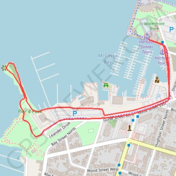
Name: Pier 4 Park trail, distance, elevation, map, profile, GPS track
Start: Hamilton, Golden Horseshoe, Ontario, L8L 1J9, Canada (43.27645 -79.86104)
End: Hamilton, Golden Horseshoe, Ontario, L8L 1J9, Canada (43.27645 -79.86104)
Coordinates: 43.27286 -79.86826 43.27645 -79.85998
Other hiking, mountain biking, running and outdoor activity trails
Click on a trail to view its statistics, map and profile.
Hamilton - Toronto
#Bike
Distance: 50.5 mi • Elevation gain: 458 m • Maximum elevation: 111 m