Thank you for supporting this site ❤️
Make a donation
Make a donation
Gear up for your next adventure:
As an Amazon Associate, this site earns from qualifying purchases at no extra cost to you.
Plympton paths
- Distance: 0.3 mi
- Elevation gain: 4 m
- Maximum elevation: 14 m
- Elevation loss: 6 m
- Minimum elevation: 11 m
- Moving time: 8 m 39 s
- Moving speed: 2.4 mph
- Maximum speed: 8.1 mph
- Total time: 8 m 39 s
- Global speed: 2.4 mph
Interactive trail map
Thank you for supporting this site ❤️
Make a donation
Make a donation
Gear up for your next adventure:
As an Amazon Associate, this site earns from qualifying purchases at no extra cost to you.
Trail profile
- Distance: 0.3 mi
- Elevation gain: 4 m
- Maximum elevation: 14 m
- Elevation loss: 6 m
- Minimum elevation: 11 m
- Moving time: 8 m 39 s
- Moving speed: 2.4 mph
- Maximum speed: 8.1 mph
- Total time: 8 m 39 s
- Global speed: 2.4 mph
Thank you for supporting this site ❤️
Make a donation
Make a donation
Gear up for your next adventure:
As an Amazon Associate, this site earns from qualifying purchases at no extra cost to you.
About this trail
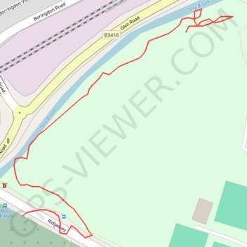
Name: Plympton paths trail, distance, elevation, map, profile, GPS track
Coordinates: 50.38905 -4.05885 50.39093 -4.05602
Topography: Plymouth topographic map, elevation, terrain
Thank you for supporting this site ❤️
Make a donation
Make a donation
Gear up for your next adventure:
As an Amazon Associate, this site earns from qualifying purchases at no extra cost to you.