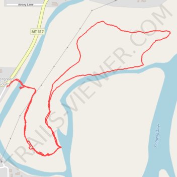
Flathead River Access
- Distance: 2.3 mi
- Elevation gain: 13 m
- Maximum elevation: 891 m
- Elevation loss: 13 m
- Minimum elevation: 886 m
- Moving time: 45 m 12 s
- Moving speed: 3.0 mph
- Maximum speed: 7.5 mph
- Total time: 47 m 6 s
- Global speed: 2.9 mph
Interactive trail map
Trail profile
- Distance: 2.3 mi
- Elevation gain: 13 m
- Maximum elevation: 891 m
- Elevation loss: 13 m
- Minimum elevation: 886 m
- Moving time: 45 m 12 s
- Moving speed: 3.0 mph
- Maximum speed: 7.5 mph
- Total time: 47 m 6 s
- Global speed: 2.9 mph
About this trail
Name: Flathead River Access trail, distance, elevation, map, profile, GPS track
Coordinates: 48.20104 -114.27725 48.20709 -114.26622