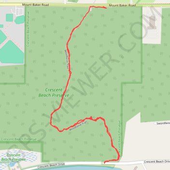
Crescent Beach Preserve
- Distance: 1.9 mi
- Elevation gain: 55 m
- Maximum elevation: 21 m
- Elevation loss: 56 m
- Minimum elevation: 5 m
- Moving time: 48 m 56 s
- Moving speed: 2.3 mph
- Maximum speed: 4.9 mph
- Total time: 1 h 7 m
- Global speed: 1.7 mph
Interactive trail map
Trail profile
- Distance: 1.9 mi
- Elevation gain: 55 m
- Maximum elevation: 21 m
- Elevation loss: 56 m
- Minimum elevation: 5 m
- Moving time: 48 m 56 s
- Moving speed: 2.3 mph
- Maximum speed: 4.9 mph
- Total time: 1 h 7 m
- Global speed: 1.7 mph
About this trail
Name: Crescent Beach Preserve trail, distance, elevation, map, profile, GPS track
Start: Woodland Trail, Eastsound, San Juan County, Washington, 98245, United States (48.70207 -122.89424)
Coordinates: 48.69562 -122.89635 48.70289 -122.89151