Import a GPX file

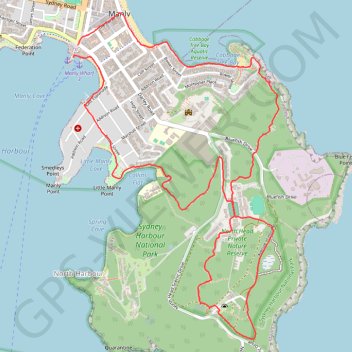
North Head via Blue Fish Track

Sydney Harbour National Park. #Hiking #Loop #Sydney

  • Distance: 5.8 mi
  • Elevation gain: 178 m
  • Maximum elevation: 101 m
  • Elevation loss: 182 m
  • Minimum elevation: 1 m
  • Moving time: 2 h 2 m
  • Moving speed: 2.9 mph
  • Maximum speed: 4.9 mph
  • Total time: 2 h 7 m
  • Global speed: 2.7 mph

Interactive trail map

Trail profile

  • Distance: 5.8 mi
  • Elevation gain: 178 m
  • Maximum elevation: 101 m
  • Elevation loss: 182 m
  • Minimum elevation: 1 m
  • Moving time: 2 h 2 m
  • Moving speed: 2.9 mph
  • Maximum speed: 4.9 mph
  • Total time: 2 h 7 m
  • Global speed: 2.7 mph

About this trail

Other hiking, mountain biking, running and outdoor activity trails

Click on a trail to view its statistics, map and profile.

Manly to Spit Bridge Walk

Australia > New South Wales > Sydney

#Hiking #Sydney

Distance: 6.7 mi • Elevation gain: 263 m • Maximum elevation: 85 m

Sydney Harbour National Park - Manly to Spit Bridge Walk

Australia > New South Wales > Sydney

#Hiking #Sydney

Distance: 11.3 mi • Elevation gain: 483 m • Maximum elevation: 98 m

Gear up for your next adventure:

🛰️Handheld GPS Devices - Reliable GPS units for hiking and outdoor navigation
📦Dry Bags - Waterproof bags to protect gear from rain
🗺️Topographic Maps - Detailed maps showing elevation and terrain features
🧭Emergency Beacons - Safety beacons for remote outdoor locations
🔋Power Banks - Portable chargers for long outdoor trips

As an Amazon Associate, this site earns from qualifying purchases at no extra cost to you.