Kankakee Sands in Illinois
- Distance: 1.6 mi
- Elevation gain: 4 m
- Maximum elevation: 203 m
- Elevation loss: 7 m
- Minimum elevation: 198 m
- Moving time: 58 m 14 s
- Moving speed: 1.7 mph
- Maximum speed: 2.7 mph
- Total time: 1 h 3 m
- Global speed: 1.5 mph
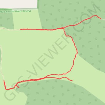
Interactive trail map
Trail profile
- Distance: 1.6 mi
- Elevation gain: 4 m
- Maximum elevation: 203 m
- Elevation loss: 7 m
- Minimum elevation: 198 m
- Moving time: 58 m 14 s
- Moving speed: 1.7 mph
- Maximum speed: 2.7 mph
- Total time: 1 h 3 m
- Global speed: 1.5 mph
About this trail
Name: Kankakee Sands in Illinois trail, distance, elevation, map, profile, GPS track
Start: South 11000 East Road, Kankakee County, Illinois, 60944, United States (41.07948 -87.65721)
End: South 11000 East Road, Kankakee County, Illinois, 60944, United States (41.07528 -87.65978)
Coordinates: 41.07470 -87.66593 41.07971 -87.65721
Other hiking, mountain biking, running and outdoor activity trails
Click on a trail to view its statistics, map and profile.
GoMap__2024_04_21__16_46_10
United States > Illinois > Kankakee County
Distance: 0.3 mi • Elevation gain: 3 m • Maximum elevation: 203 m