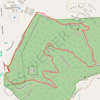
Netherby Spur - Harold's Lookout
Interactive trail map
Trail profile
- Distance: 2.9 mi
- Elevation gain: 243 m
- Maximum elevation: 339 m
- Elevation loss: 243 m
- Minimum elevation: 170 m
- Moving time: 1 h 4 m
- Moving speed: 2.7 mph
- Maximum speed: 4.3 mph
- Total time: 1 h 5 m
- Global speed: 2.6 mph
About this trail
Name: Netherby Spur - Harold's Lookout trail, distance, elevation, map, profile, GPS track
Coordinates: -34.97910 138.63628 -34.97133 138.64791
Other hiking, mountain biking, running and outdoor activity trails
Click on a trail to view its statistics, map and profile.
Belair National Park - Mount Lofty
Australia > South Australia > Adelaide
#Bike
Distance: 8.1 mi • Elevation gain: 503 m • Maximum elevation: 704 m