Along the Sturt River
- Distance: 1.0 mi
- Elevation gain: 13 m
- Maximum elevation: 193 m
- Elevation loss: 31 m
- Minimum elevation: 165 m
- Moving time: 18 m 7 s
- Moving speed: 3.3 mph
- Maximum speed: 8.3 mph
- Total time: 18 m 47 s
- Global speed: 3.2 mph
Interactive trail map
Trail profile
- Distance: 1.0 mi
- Elevation gain: 13 m
- Maximum elevation: 193 m
- Elevation loss: 31 m
- Minimum elevation: 165 m
- Moving time: 18 m 7 s
- Moving speed: 3.3 mph
- Maximum speed: 8.3 mph
- Total time: 18 m 47 s
- Global speed: 3.2 mph
About this trail
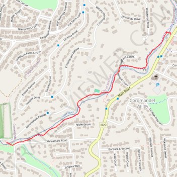
Name: Along the Sturt River trail, distance, elevation, map, profile, GPS track
Coordinates: -35.04756 138.61370 -35.04076 138.62572