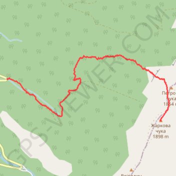
Vertikal Zarkova cuka v1
- Distance: 3.0 mi
- Elevation gain: 888 m
- Maximum elevation: 1,841 m
- Elevation loss: 48 m
- Minimum elevation: 996 m
Interactive trail map
Trail profile
- Distance: 3.0 mi
- Elevation gain: 888 m
- Maximum elevation: 1,841 m
- Elevation loss: 48 m
- Minimum elevation: 996 m
About this trail
Name: Vertikal Zarkova cuka v1 trail, distance, elevation, map, profile, GPS track
Coordinates: 43.39004 22.60511 43.39890 22.63540
Other hiking, mountain biking, running and outdoor activity trails
Click on a trail to view its statistics, map and profile.
STARA PLANINA: Topli Do - BABIN ZUB (1.758) - DUPLJAK (2.032...
Serbia > Central Serbia > Pirot Administrative District > Topli Do
Distance: 21.3 mi • Elevation gain: 2,173 m • Maximum elevation: 2,159 m
UTSP 2020 - SkyTrail 13km
Serbia > Central Serbia > Zajecar Administrative District > Knjazevac Municipality > Custica
Odmah iza Tupanara granicnom stazom do Vucjih jama pa Dupljak, povratak starom uraslom stazom kroz kleke do sedla i opet istim putem nazad do B.zuba
Distance: 7.9 mi • Elevation gain: 747 m • Maximum elevation: 1,809 m