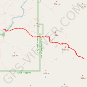
Romero Canyon
Hike to Romero Canyon via Canyon Loop Trail and Romero Trail in the Catalina State Park, the Bighorn Sheep Management Area and the Pusch Ridge Wilderness. #Hiking #Canyon #Mountain #Nature #Wilderness
- Distance: 5.9 mi
- Elevation gain: 451 m
- Maximum elevation: 1,148 m
- Elevation loss: 451 m
- Minimum elevation: 828 m
Interactive trail map
Trail profile
- Distance: 5.9 mi
- Elevation gain: 451 m
- Maximum elevation: 1,148 m
- Elevation loss: 451 m
- Minimum elevation: 828 m
About this trail
Name: Romero Canyon trail, distance, elevation, map, profile, GPS track
Start: Bridle Trail, Pima County, Arizona, United States (32.42514 -110.90862)
End: Bridle Trail, Pima County, Arizona, United States (32.42514 -110.90862)
Coordinates: 32.41431 -110.90862 32.42593 -110.87253