Island Lake State Rec Area trails in Green Oak Township, MI
Island, Lake, State, Rec, Area, Trails, Green, Oak, Township
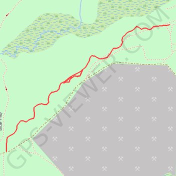
- Distance: 0.4 mi
- Elevation gain: 10 m
- Maximum elevation: 278 m
- Elevation loss: 4 m
- Minimum elevation: 272 m
- Moving time: 8 m 23 s
- Moving speed: 3.0 mph
- Maximum speed: 4.0 mph
- Total time: 8 m 23 s
- Global speed: 3.0 mph
Interactive trail map
Trail profile
- Distance: 0.4 mi
- Elevation gain: 10 m
- Maximum elevation: 278 m
- Elevation loss: 4 m
- Minimum elevation: 272 m
- Moving time: 8 m 23 s
- Moving speed: 3.0 mph
- Maximum speed: 4.0 mph
- Total time: 8 m 23 s
- Global speed: 3.0 mph
About this trail
Name: Island Lake State Rec Area trails in Green Oak Township, MI trail, distance, elevation, map, profile, GPS track
Coordinates: 42.49078 -83.71785 42.49336 -83.71334