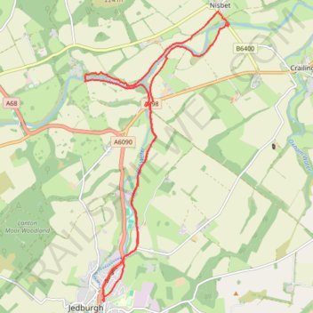
River Teviot Bike Loop from Jedburgh
- Distance: 9.4 mi
- Elevation gain: 130 m
- Maximum elevation: 93 m
- Elevation loss: 129 m
- Minimum elevation: 50 m
- Moving time: 1 h 8 m
- Moving speed: 8.2 mph
- Maximum speed: 24.9 mph
- Total time: 2 h 21 m
- Global speed: 4.0 mph
Interactive trail map
Trail profile
- Distance: 9.4 mi
- Elevation gain: 130 m
- Maximum elevation: 93 m
- Elevation loss: 129 m
- Minimum elevation: 50 m
- Moving time: 1 h 8 m
- Moving speed: 8.2 mph
- Maximum speed: 24.9 mph
- Total time: 2 h 21 m
- Global speed: 4.0 mph
About this trail
Name: River Teviot Bike Loop from Jedburgh trail, distance, elevation, map, profile, GPS track
Start: Waterside Road, Jedburgh, Scottish Borders, Scotland, TD8 6HA, United Kingdom (55.47861 -2.55064)
Coordinates: 55.47848 -2.55569 55.52337 -2.51627
Topography: Scottish Borders topographic map, elevation, terrain