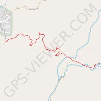
Import a GPX file

Cedar Creek Falls

Hike to Cedar Creek Falls via San Diego River Gorge Trail in the Cleveland National Forest. #Hiking #Falls #River #Nature #Mountain

  • Distance: 2.7 mi
  • Elevation gain: 59 m
  • Maximum elevation: 564 m
  • Elevation loss: 290 m
  • Minimum elevation: 279 m

Interactive trail map

Trail profile

  • Distance: 2.7 mi
  • Elevation gain: 59 m
  • Maximum elevation: 564 m
  • Elevation loss: 290 m
  • Minimum elevation: 279 m

About this trail

Name: Cedar Creek Falls trail, distance, elevation, map, profile, GPS track

Start: Thornbush Road, San Diego County, California, United States (32.99521 -116.75633)

End: San Diego River Gorge Trail, San Diego County, California, United States (32.98989 -116.73014)

Coordinates: 32.98894 -116.75633 32.99735 -116.73014

Gear up for your next adventure:

🧥Breathable Waterproof Jackets - Essential rain protection for the unpredictable British climate
🗺️Scratch-off Peak Maps - Track your progress climbing Munros or Wainwrights
🧣Fleece Neck Warmers - Extra insulation for winter topographic surveys
👕Technical Hiking Tees - Moisture-management for high-exertion climbs
🧺Mesh Stuff Sacks - Breathable storage for wet gear or camp organization

As an Amazon Associate, this site earns from qualifying purchases at no extra cost to you.