Import a GPX file

Wungong Gorge

#Hiking #Loop

  • Distance: 9.3 mi
  • Elevation gain: 621 m
  • Maximum elevation: 264 m
  • Elevation loss: 621 m
  • Minimum elevation: 57 m

Interactive trail map

Trail profile

  • Distance: 9.3 mi
  • Elevation gain: 621 m
  • Maximum elevation: 264 m
  • Elevation loss: 621 m
  • Minimum elevation: 57 m

About this trail

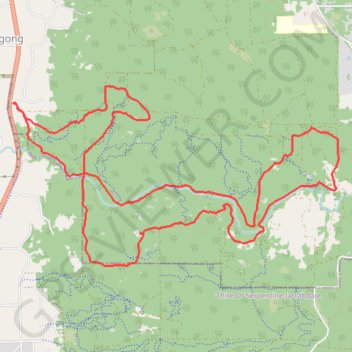
Name: Wungong Gorge trail, distance, elevation, map, profile, GPS track

Start: Rails Crescent, Wungong, City Of Armadale, Western Australia, 6122, Australia (-32.18928 116.01574)

End: Rails Crescent, Wungong, City Of Armadale, Western Australia, 6122, Australia (-32.18928 116.01574)

Coordinates: -32.20542 116.01574 -32.18756 116.05385

Gear up for your next adventure:

🍱Food Containers - Reusable containers for outdoor meals
🛌Sleeping Mats - Insulated mats for comfortable outdoor sleeping
🚲Bikepacking Frame Bags - Storage for tools and navigation gear on long off-road rides
🛰️Satellite Messengers - Emergency communication devices for areas without mobile signal
💧Hydration Reservoirs - Convenient water bladders for hands-free drinking on the move

As an Amazon Associate, this site earns from qualifying purchases at no extra cost to you.