Indian Falls
Indian Falls Conservation Area. Georgian Bay. Lake Huron. #Hiking #Running #IndianFalls #Huron
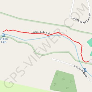
- Distance: 0.9 mi
- Elevation gain: 25 m
- Maximum elevation: 208 m
- Elevation loss: 25 m
- Minimum elevation: 185 m
Interactive trail map
Trail profile
- Distance: 0.9 mi
- Elevation gain: 25 m
- Maximum elevation: 208 m
- Elevation loss: 25 m
- Minimum elevation: 185 m
About this trail
Name: Indian Falls trail, distance, elevation, map, profile, GPS track
Start: Grey Road 1, Georgian Bluffs, Grey County, Ontario, N4K 5N4, Canada (44.61941 -80.94763)
End: Grey Road 1, Georgian Bluffs, Grey County, Ontario, N4K 5N4, Canada (44.61941 -80.94763)
Coordinates: 44.61939 -80.95465 44.62129 -80.94763