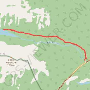
Boom Lake Trail
Banff National Park. #Hiking #Snowshoeing #Banf #Lake #Forest
- Distance: 6.6 mi
- Elevation gain: 267 m
- Maximum elevation: 1,934 m
- Elevation loss: 267 m
- Minimum elevation: 1,733 m
Interactive trail map
Trail profile
- Distance: 6.6 mi
- Elevation gain: 267 m
- Maximum elevation: 1,934 m
- Elevation loss: 267 m
- Minimum elevation: 1,733 m
About this trail
Name: Boom Lake Trail trail, distance, elevation, map, profile, GPS track
Start: Boom Lake Trail, Improvement District No. 9, Alberta, Canada (51.24924 -116.02431)
End: Boom Lake Trail, Improvement District No. 9, Alberta, Canada (51.24928 -116.02431)
Coordinates: 51.24907 -116.08457 51.26381 -116.02292