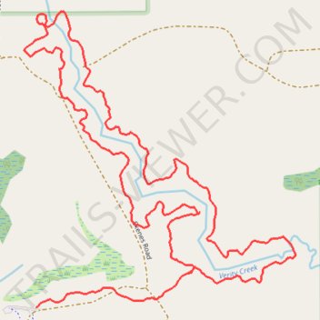
Verity Creek Loop Trail in Au Sable State Forest - Gladwin Unit
- Distance: 2.0 mi
- Elevation gain: 9 m
- Maximum elevation: 205 m
- Elevation loss: 7 m
- Minimum elevation: 198 m
- Moving time: 51 m 47 s
- Moving speed: 2.3 mph
- Maximum speed: 4.3 mph
- Total time: 54 m 14 s
- Global speed: 2.2 mph
Interactive trail map
Trail profile
- Distance: 2.0 mi
- Elevation gain: 9 m
- Maximum elevation: 205 m
- Elevation loss: 7 m
- Minimum elevation: 198 m
- Moving time: 51 m 47 s
- Moving speed: 2.3 mph
- Maximum speed: 4.3 mph
- Total time: 54 m 14 s
- Global speed: 2.2 mph
About this trail
Name: Verity Creek Loop Trail in Au Sable State Forest - Gladwin Unit trail, distance, elevation, map, profile, GPS track
Start: Skenes Road, Edenville Township, Midland County, Michigan, 48657, United States (43.74251 -84.42057)
End: Skenes Road, Edenville Township, Midland County, Michigan, 48657, United States (43.74321 -84.41625)
Coordinates: 43.74251 -84.42090 43.74856 -84.41322